|
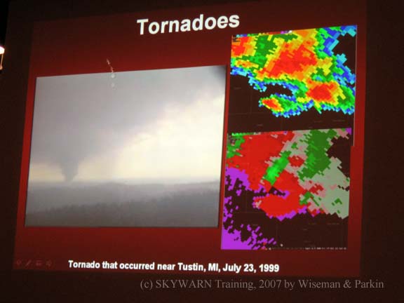
This is how the weather people from the National Weather Service and TV see tornadoes on their radars.
They use these programs to help them predict tornadoes so they can issue a warning and help save more lives! The picture
on the left is what you and I (and my brother) see. The top one on the right is normal radar, and the lower right picture
is radar showing the cold and the hot air cells (the green and the red) moving over top of each other and forming
a tornado!!
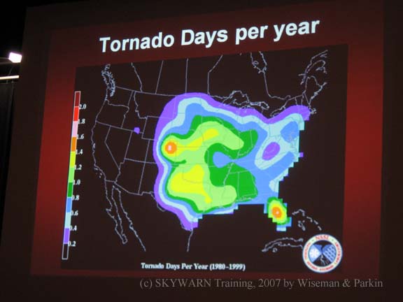
Don't stress out though! According to this picture, the National Weather Service says we only get
about 1 day a year that actually produces tornadoes-- it does not happen very often in Michigan!!
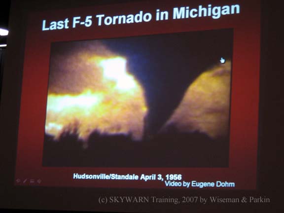
(For video of this last F5, click here:)
(No volume).
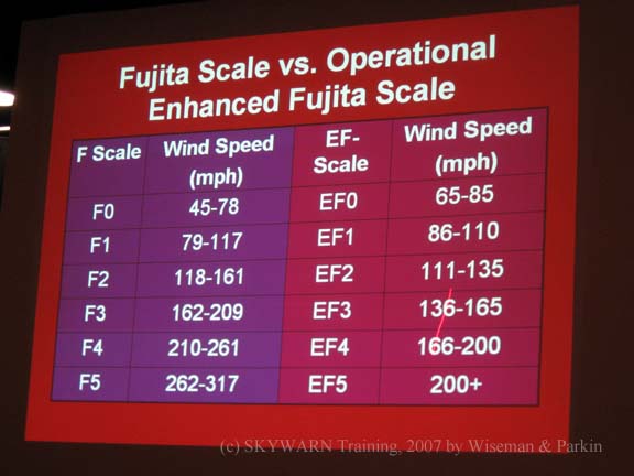
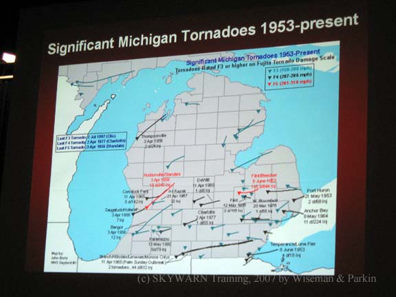
In this picture, as you can see, there are three line colors: Red
is the most dangerous-- the F4's and F5's, the biggest tornadoes. The black lines are the
F2's and F3's-- the medium size tornatoes. The bluish-green color are
the F0's and F1's-- the smallest tornadoes.
As a good thing to notice-- which tornadoes do we have the most of? The blue colored lines!
Right! Which are the smallest tornado! We have only had a few big tornadoes in the last 60 years!! I hope
we never see a big on!!
|